LOST HORIZONS
Google Earth, video, and panoramic photography
Proposed research
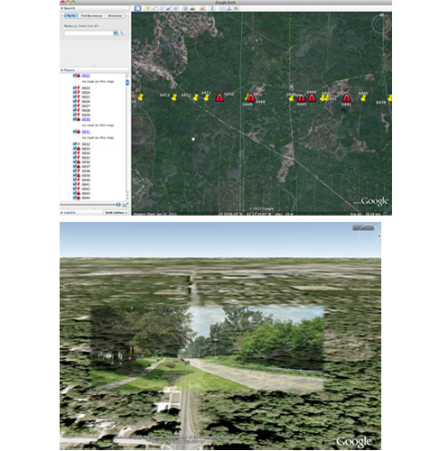
Lost Horizons uses the practice of ground truthing to understand the dichotomy between the disembodied virtual space of remote sensing data/Google Earth and the lived experience on the ground, contrasting the densely vegetated, multilayered, multi-cultured environment of North Florida with the packaged, essentialized perspective of satellite imagery. Part of the quintessential Florida tourist adventure is viewing the horizon, the beach landscape at dawn and dusk mythologized by snapshots and postcards. I attempt to travel from coastal Jacksonville to Route 30 near Mexico Beach stopping at points created by the intersection of roads and the 30th parallel. The 30th parallel North has mystical significance for some as it crosses the site of the pyramids in Egypt. In Florida, it passes through upscale subdivisions in Jacksonville, bombing ranges, USAF installations, timber concessions, the occasional mine—lands that are rarely frequented by the casual passerby. At each point I walk a pixel of land, shoot video and a panoramic photo initially placing each image as VR panorama into Google Earth. The final piece will be a series of interactive postcards where the participant jumps into the postcard in GE and explores each intersection creating a "Street View" where many times one does not exist.